Data & Tools
PacIOOS
|
PacIOOS Voyager
|
USGS Rainfall Gauge
|
Data Trends in Water Quality and Percent Live Coral Cover
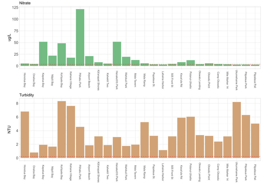
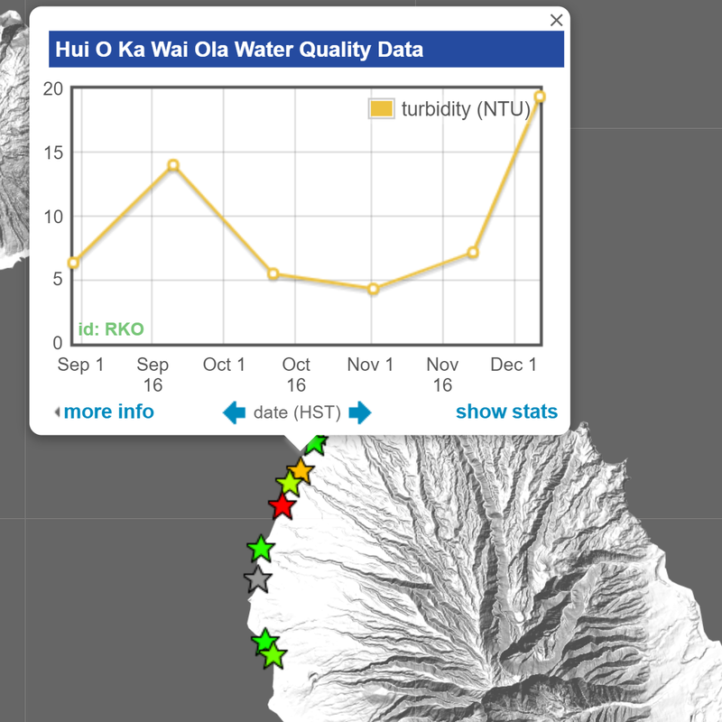
Hui O Ka Wai Ola data through Dec.2023 showing geomeans for nitrate nitrite nitrogen (green bars) and turbidity (water clarity) in brown relative to the Hawaii Department of Health state standards shown in the dashed red lines. Sites go from the north at Honolua Bay to the Pali in the south.
|
Hui O Ka Wai Ola collects data for ocean salinity, pH, temperature, organic nutrients (nitrogen and phosphorous compounds), dissolved oxygen (DO), and turbidity. Some water samples are immediately tested at mobile labs, while others are processed for testing at University of Hawaiʻi.
Hot off the press June 2022!
Read the latest report for more information on the Hui and additional results. |
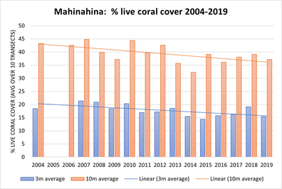
Long-term Percent Live Coral Cover Data
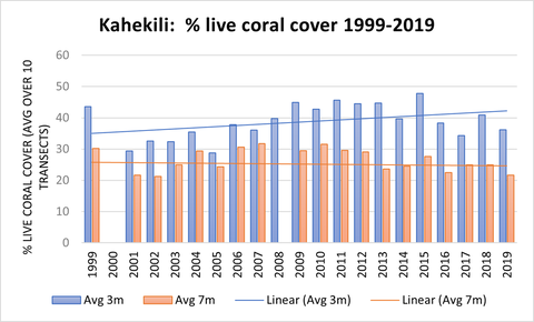
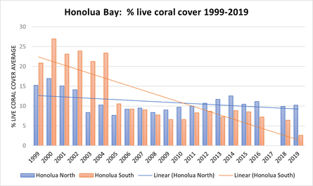
Click graphs for link to comprehensive 2015 DAR CRAMP report.
|
|
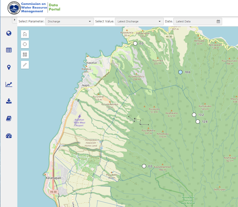
Commision of Water Resource Management (CWRM) StreamflowIn recent years, CWRM has installed additional stream gauges in West Maui (and beyond) to help determine flow, and in some areas, turbidity. This data is now available through this data portal.
|
Pesticide Detection Study Map- Results coming soon
|